My Previous Projects
This is only a listing of the major projects I have worked on outside of classes up through my Master's degree. The projects are summed up in a couple of lines and a few images to show what was done. This is not meant to be the all encompassing project, just a little snippet of it.
Undergraduate Work (2001 - 2002)
Lehane, J.R. and Over, D.J. 2002. Canid and rodent scavenging on Pleistocene cave bear: Geological Society of America Abstracts with Programs 34 (6); p.150
This was the first real project that I worked on. It was for my invertebrate paleontology class but since my professor knew how much I was into vertebrates he let me work on this instead. The goal of the project was to show that scavenging occurred to Pleistocene cave bear bones by comparing it to teeth marks made on pig bones by mice and a dog.
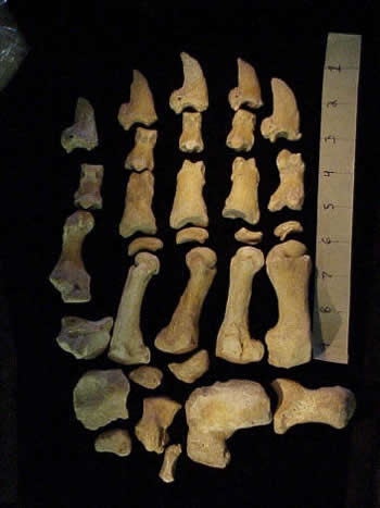
The cave bear, Ursus spelaeus, front right paw
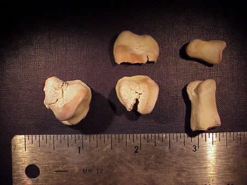
The pig bones used for chew mark comparisons
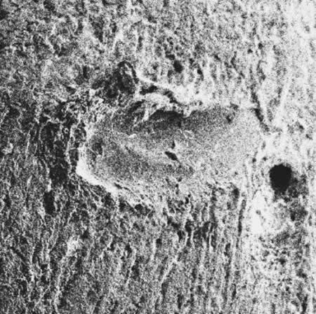
SEM (Scanning electron microscope) image of dog chew mark
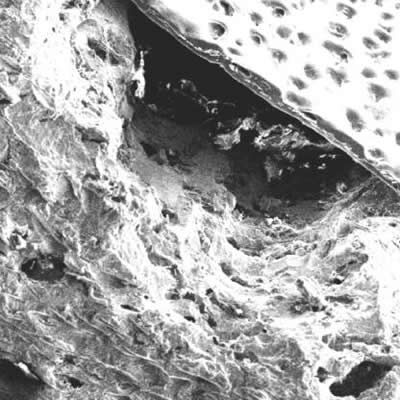
SEM image of mouse chew mark
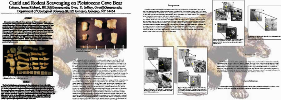
The poster presented as the GSA convention, 2002
Undergraduate Work (cont. 2002 - 2003)
Young, R.A. 2003. Recent and long-term sedimentation and erosion along the Genesee River floodplain in Livingston and Monroe Counties, NY. Funded by the US Army Corps of Engineers. pp. 1-40
This project was funded through the US Army Corps of Engineers and directed by Dr. Young. The purpose was to find different erosion rates along the Genesee River from Mount Morris to Rochester, NY and to discover a cause for faster erosion and possibly a solution. This required several different aspects with the first part including a fellow geology student, Jeff Mortier. The two of us canoed the river between these two cities. All the while mapping the edge of the river with GPS points, measuring the width with a laser distancing tool, and documenting the location with digital photographs. Then using ArcGIS 8.0, I rectified aerial photographs of the river from different years, traced the rivers, and finally included the current river location using the GPS positions.
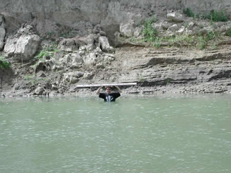
Me being used as Dr. Young's pawn and holding a scale
for point bar and overbank sediment.
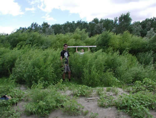
Me and Jeff holding a scale to show tree height along a meander point bar (actually at the B on the map directly below)
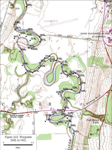
One small section on the river showing the GPS locations. Note the location of the points around 334. The edge of the river is not even near where it is on the map.
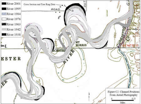
The fastest eroding meander of the Genesee River. I created the map using aerial photographs from the years listed and overlying them using "permanent structures" as anchor points like roads and buildings. Then the river was traced over with the black line representing the most recent location.
Master's Research (2003 - 2005)
Lehane, J.R. 2005. Anatomy and relationship of Shuvosaurus, a basal theropod from the Triassic of Texas. Masters Thesis Texas Tech University, Lubbock, Texas.
Click here to download a copy of my thesis
My Master's thesis project involved rebuilding a skull attributed to the "dinosaur" Shuvosaurus inexpectatus. The skull first needed to be taken apart, cleaned, and un-distorted. These pieces then needed to be cast and their mirror images needed to be created since only 1/2 the skull remained. Finally, some of the missing pieces needed to be created.
Lateral view of the pre-reconstructed skull
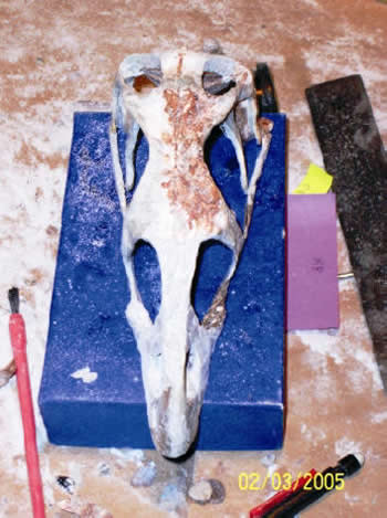
The completed reconstruction dorsal (top) view.
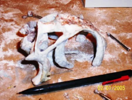
The back half of the reconstructed skull
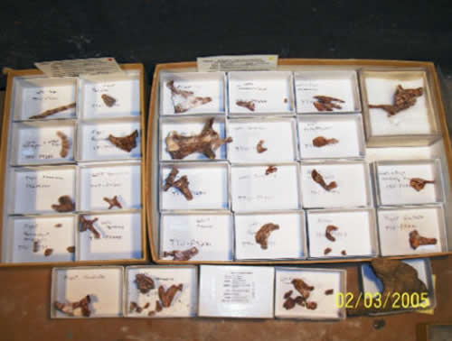
View of all the actual bones after they were cleaned and pieced backed together.
Lateral view of the post-reconstructed skull. The outline of this skull is also the background for the website
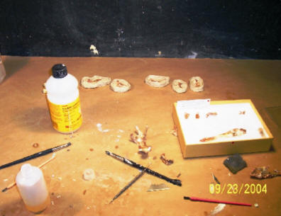
Part of the process of casting the bones. They need to be coated in rubber in 2 parts with clay covering the part not being duplicated
