
-Stage 3.3-
Geological Maps
Example of Topographic Map
(actual scan of the Wyndale and Holston Valley Quadrangles, Virginia)
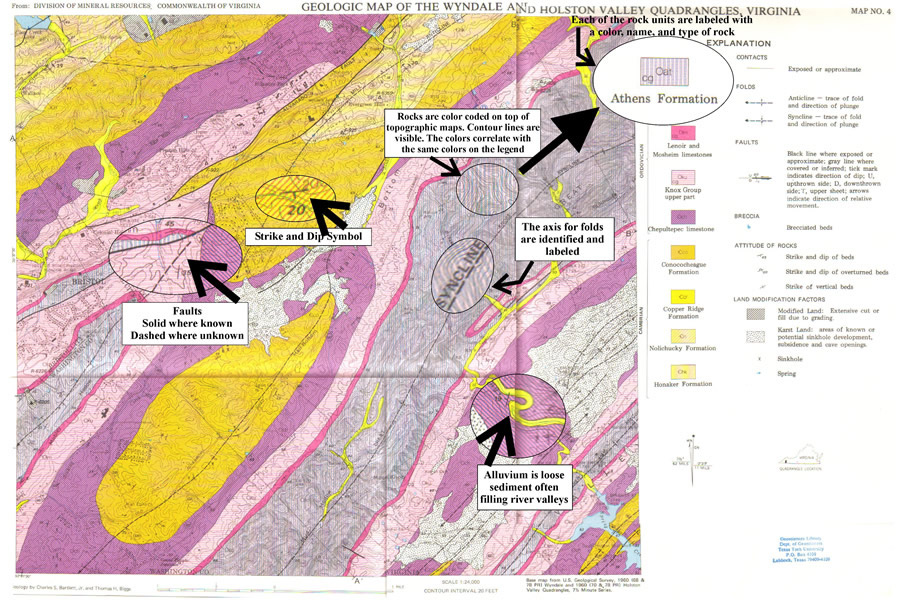
Geological maps are topographic maps with the geological units drawn on them. Typically there are 2 topographic quadrangles in one geological map. What a geological map shows is what types of rocks are exposed on the surface. When no rocks are visible on the surface the type of rock is hypothesized. Other features unique to a geological map:
Faults:
- Solid fault lines indicate where the fault is visible and/or known
- Dashed fault lines indicated where a fault is known but the exact location is not certain
Folds:
- The axis for anticlines and synclines are drawn
- Strike and Dip symbols
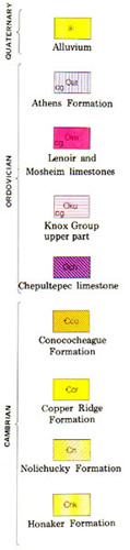
Geological Legend
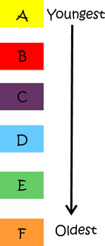
The legends (pictured on the right and left) are listed with the oldest rock units on the bottom and the youngest on the top. This is just like real life where the oldest rocks are on the bottom then progressively younger rocks get layered on top. The relative ages of the rocks are usually listed along the side of the units.
On the map above and the legend to the right the relative rock ages are Cambrian, Ordovician, and Quaternary
Alluvium is loose sediment fill common to flood plains, beaches and anywhere there is active sediment movement.
A profile (as explained on the Topo Maps page) is a section of a map where you can look at the rock structure below the surface. Geological profiles are always related to a geological map and represent a line that is drawn across the map. It is often used to enhance an interesting structure and often looks like a cross between the front of the blocks in the Structures section and a topographic profile.
To create a geological profile you would need to know the strike and dips of the rocks. Very rarely do these intersect with a cross section line so a lot of estimates are required.
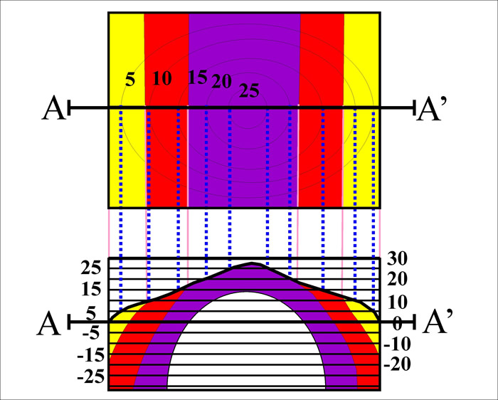
Understanding the Geological Profiles
-
The upper block represents the map.
-
The lower block is the profile based from the map, similar to a topographic profile.
-
The difference is the rock units are on the profile. Rock units are angled under the ground based on strike and dips determined from field work.
-
The area below the purple unit it not drawn in because it is unknown on the surface, therefore it is just left blank.
